

Xinjiang
Magazine-style destination guide
Xinjiang unfurls across the far northwest of China as a continent-scale crossroads where the Altai, Tianshan, Kunlun, and Pamir ranges cradle vast deserts, alpine lakes, glacier-fed rivers, subalpine meadows, ancient Silk Road oasis towns, and a deep well of Turkic, Uyghur, Kazakh, Tuvan, and Kyrgyz cultures. The scale is overwhelming, yet the most memorable moments are intimate: the silence around a turquoise glacial lake, the rhythm of horse hooves on the Aerial Grassland, the cool hush inside a Turpan karez tunnel, the call to prayer drifting over Kashgar’s mud-brick alleyways.
This guide follows nine defining chapters of the region, from Kanas and Hemu in the Altai, across Sayram Lake, Nalati, the Duku Highway, and Kashgar, to the Pamir lakes, Tianshan Tianchi, and the Turpan Basin.
01 · Altai Wilderness
Kanas Nature Reserve
喀纳斯景区
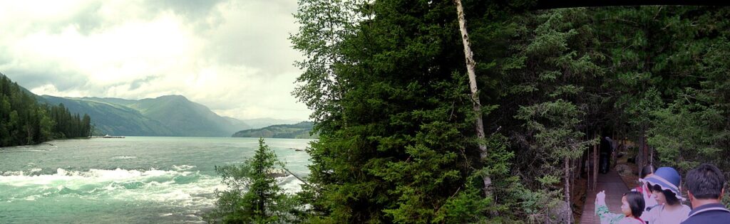
Overview: Hidden deep within the Altai Mountains near the borders of China, Russia, Kazakhstan, and Mongolia, Kanas is an alpine glacial sanctuary famed for its pristine Siberian taiga forests, indigenous Tuvan culture, and a legendary crescent-shaped lake whose waters shift color with the seasons.
Highlights: The Three River Bays (Immortal Bay, Moon Bay, and Dragon Bay), where the turquoise Kanas River meanders through dense golden birch and larch woods; and the Fish-Viewing Pavilion (Guanyutai), perched on Camel Peak 600 meters above the lake, offering sweeping vistas of Mount Youyi’s glaciers.
Best Time to Visit: Mid-to-late September, when autumn turns the taiga into an intense palette of amber, crimson, and deep emerald beneath snow-dusted peaks.
02 · God’s Self-Retained Land
Hemu Village
禾木村
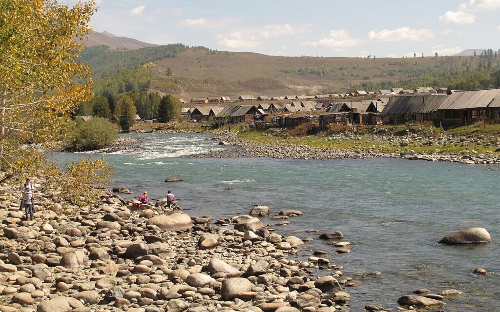
Overview: Often celebrated as “God’s Self-Retained Land,” Hemu is a serene alpine hamlet inhabited primarily by the ethnic Tuvan people (a branch of Mongolians) and Kazakh herders, tucked inside a river basin framed by ancient birch forests and snow ridges.
Highlights: Traditional wooden log cabins (Tuowa), horse herds grazing across open meadows, and the crystal-clear Hemu River flowing over rounded river stones.
Signature Experience: Hiking to the village observation platform before dawn to witness the iconic sunrise: golden morning light breaking over the ridges, illuminating the veil of mist and gentle ribbons of woodsmoke drifting from log cabin chimneys.
03 · Last Tear of the Atlantic
Sayram Lake
赛里木湖
Overview: Resting at an elevation of 2,073 meters in the northern Tianshan Mountains, this is the largest and highest alpine lake in Xinjiang. Because it marks the easternmost point reached by warm, moist air currents from the Atlantic Ocean, it is poetically called “The Last Tear of the Atlantic.”
Highlights: Pure, cobalt-blue waters ringed by snowcapped peaks, wild swan colonies along the shallows, vibrant carpets of alpine wildflowers in summer, and phenomenal deep-blue ice formations and frozen bubble columns during winter.
Tip: Drive or take the eco-shuttle along the 90-kilometer paved perimeter highway. Stop at Songshutou at the lake’s southern exit to hike up the ridge for a dual view of the sapphire lake on one side and the dramatic arches of the Guozigou Bridge curving through the canyon on the other.
04 · The Sun-Facing Place
Nalati Grassland
那拉提草原
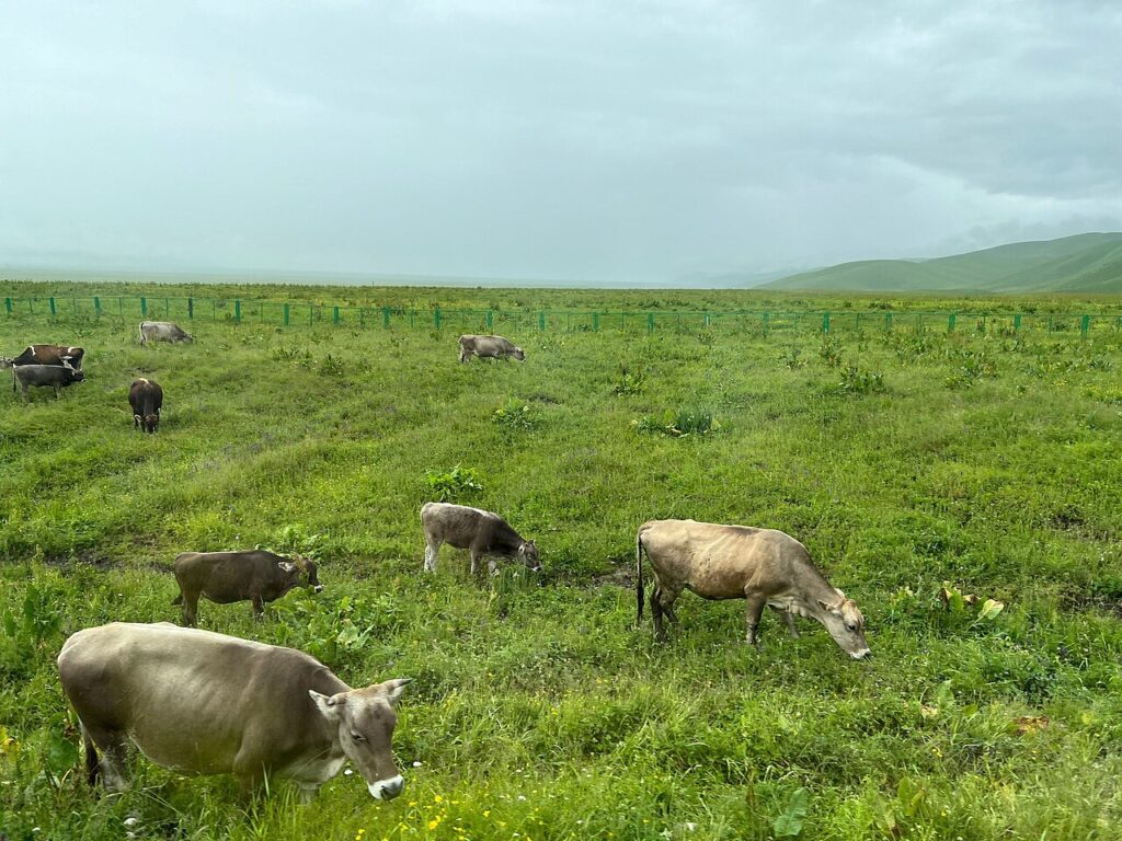
Overview: Meaning “The Sun-Facing Place” in Mongolian, Nalati is one of the world’s four major subalpine river-basin meadows, located in the fertile Ili River Valley and framed by towering Tianshan spruce forests and glaciers.
Highlights: The undulating “Aerial Grassland” (Kongzhong Caoyuan) perched high along mountain ridges, dotted with grazing sheep, galloping horses, and white Kazakh felt yurts beneath snow-capped peaks.
Signature Experience: Riding a horse guided by local Kazakh horsemen through the wild thyme and iris fields up to the Nomads’ Homeland, followed by resting in an authentic yurt to taste hot milk tea (Naicha) and fresh spit-roasted mutton.
05 · Tianshan Spine Road
The Duku Highway
独库公路 / G217
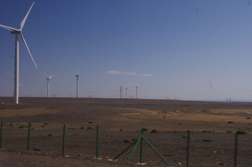
Overview: Stretching 561 kilometers across the spine of the Tianshan mountain range from Dushanzi to Kuqa, this engineering marvel was carved through sheer cliffs and frozen permafrost over a decade by the Chinese military, connecting northern and southern Xinjiang.
Highlights: Celebrated for offering “four seasons in a single day, and different scenery every ten miles”—transitioning dramatically from crimson Danxia canyons and wind-swept gravel plains to snowy mountain passes, alpine spruce forests, and high-altitude wetlands.
Strategy: The highway is open strictly during summer and early autumn (generally mid-June to early October) due to heavy winter snow and rockslides. Access is limited to passenger vehicles with 7 seats or fewer. Check real-time weather and traffic advisories before departure.
06 · Silk Road Oasis
Kashgar Old Town
喀什古城
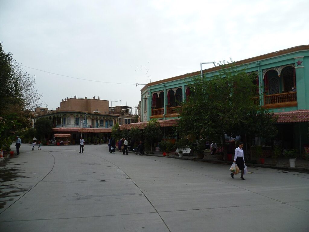
Overview: Serving as a vital oasis crossroads on the ancient Silk Road for more than two millennia, Kashgar Old Town is one of the world’s largest living earthen architectural complexes, radiating authentic Uyghur folk life, culinary culture, and artisanal heritage.
Highlights: A labyrinth of over 90 cobblestone lanes lined with mud-brick homes, carved poplar balconies, coppersmith alleys, carpet bazaars, and the historic Id Kah Mosque with its grand prayer hall and yellow-glazed façade.
Signature Experience: Ascending to the tapestried second floor of the Centennial Teahouse along Century Avenue, sipping hot saffron-clove herbal tea with crispy sesame naan, while listening to elder musicians perform folk ballads on the rawap and dutar.
07 · Roof of the World
Pamir Plateau: Baisha Lake & Karakul Lake
帕米尔高原:白沙湖与卡拉库里湖
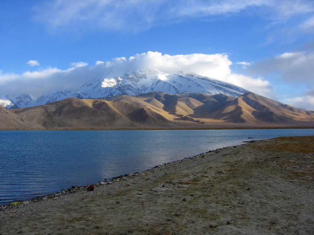
Overview: Located in southwestern Xinjiang along the Karakoram Highway (G314), this dramatic segment of the Pamir Plateau (“The Roof of the World”) showcases high-altitude glacial landscapes where arid white dunes meet pristine alpine waters.
Highlights: Baisha Lake (White Sand Lake), famous for chalk-white sand dunes rising straight out of mirror-flat turquoise waters; and Karakul Lake, resting at 3,600 meters directly at the foot of Muztagh Ata (7,546 meters), revered as the “Father of Ice Mountains.”
Tip: Non-local travelers must obtain a Border Defense Permit (Bianfangzheng) in Kashgar before heading toward the plateau. Due to the high altitude and rapid temperature drops, keep windproof thermal jackets, polarized sunglasses, and portable oxygen canisters accessible in the car.
08 · Daoist Sacred Pool
Tianshan Tianchi / Heavenly Lake
天山天池
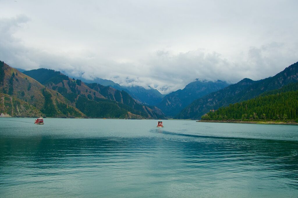
Overview: Situated 90 kilometers east of Urumqi in the Bogda Mountain Range, this crescent-shaped alpine moraine lake sits at 1,910 meters, steeped in ancient Daoist legends surrounding the Queen Mother of the West (Xiwangmu).
Highlights: Deep jade-green waters mirroring the snow-crowned Bogda Peak (5,445 meters), dense Siberian spruce groves lining the cliffs, and historic temples like the Blessed Mother Palace perched beside the water.
Strategy: Take the electric shuttle bus up the mountain and stroll along the east-bank boardwalk to escape the main tourist plaza. If time permits, ride the Maya Mountain Cable Car for a bird’s-eye perspective looking down across the lake basin with the glacier-draped peak of Mount Bogda in full view.
09 · Fire Basin & Underground River
Turpan: Flaming Mountains & Karez Well System
吐鲁番:火焰山与坎儿井
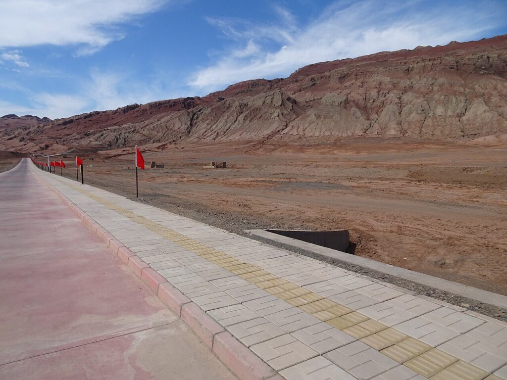
Overview: Resting within the Turpan Basin—the second-lowest exposed land depression on Earth—this region pairs blistering surface heat with an ingenious, ancient subterranean irrigation network that turns a barren desert into a fertile fruit oasis.
Highlights: The Flaming Mountains, where rust-red sandstone ridges resemble tongues of fire under summer temperatures exceeding 45°C (immortalized in the classic epic Journey to the West); and the Karez System, an underground network of hand-dug wells and gravity-fed aqueducts channeling Tianshan snowmelt beneath the scorching desert.
Signature Experience: Escaping the midday desert heat by descending into the cool underground galleries of the Karez Museum, followed by relaxing under shaded grape trellises in Grape Valley to sample sweet seedless Turpan green raisins and sweet melons.
Plan a private Xinjiang journey
Tell us your dates and travel style — we will craft a thoughtful itinerary across Xinjiang’s alpine lakes, Silk Road towns, and Tianshan grasslands.